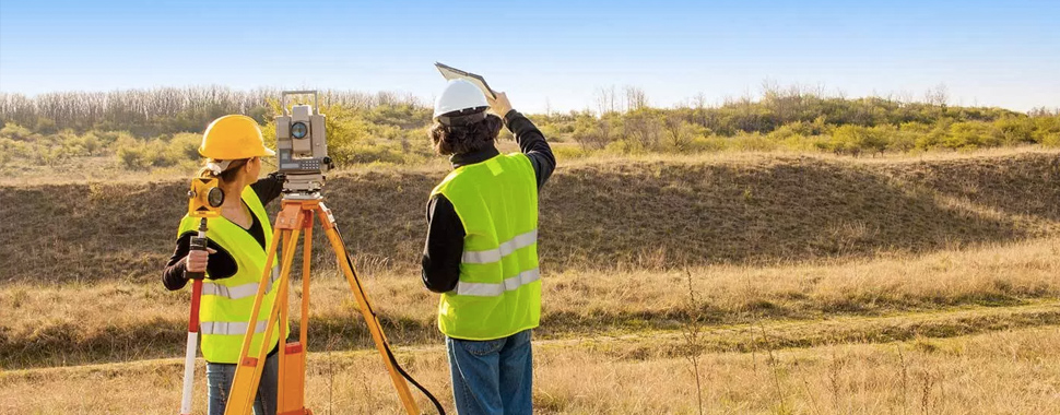
TriState Planning Engineering & Land Surveying, P.C. offers a vast array of services for all your project’s land surveying and mapping needs. Our survey team offers innovative solutions coupled with state-of-the-art technology to ensure projects are completed in accordance with our stringent internal quality standards. Our NYS Licensed Land Surveyors and NSPS Certified Survey Technicians lead our team of field and office personnel to ensure all projects are completed accurately and on time.
Our staff have extensive experience completing projects for both private engineering and architectural firms, as well as working directly with local government, municipalities and public agencies, including:
- NYCDDC
- NYSDOT
- PANYNJ
- NYCDOT
- NYCDEP
- MTA
- NYS Parks
- NYC Parks & Recreation
- NCDPW
- SCDPW
Services Available
- Boundary Surveys
- Right-of-Way & Acquisition Surveys
- High Precision Control Surveys
- Topographic Surveys
- Railroad, Highway and Bridge Surveys
- Utility & Infrastructure Surveys
- LiDAR/Photogrammetric Control Surveys
- Construction Surveys & Lay-out
- Utility & Highway Profiles
- Digital Terrain Modeling
- Engineering/Architectural Surveys
- ALTA/ACSM Surveys
- FEMA Elevation Certificates
- Subdivision/Land Planning
LiDAR Scanning
Our cutting-edge LiDAR scanning equipment allows us to collect millions of points of data in exponentially less time than conventional survey methods. Each of these points collected will have 3-dimensional geospatial coordinates, and each scan is georeferenced to panoramic photos taken by the scanner as well. The data set produced is called a point cloud. Our scanning equipment automatically registers the scans for each project, producing one continuous point cloud while our staff continue to work in the field. This saves the time in the office that previous LiDAR scanning systems required technicians to manipulate and register each scan with the others, and with survey control. In the office, the software we utilize will reconcile the photographs with the point cloud to produce a color, 3D model of the project site. TSPE can deliver this complete point cloud to our clients, which is easily imported into third-party software such as Civil 3D, Recap or Revit. We can also manipulate and utilized the data to create 2D or 3D CAD drawings, topographic surveys, 3D renderings, and Digital Terrain (Surface) Models. Having multiple delivery options allows TSPE to meet our any of our clients’ needs, by providing them with the most comprehensive and complete data sets possible.
Equipment Details
The TSPE team has extensive experience employing terrestrial LiDAR (3D Laser) scanners, across a variety of project types. LiDAR scanning captures more data that traditional survey techniques, eliminating the potential need for return trips to the field for additional information. In addition to saving time, utilizing Lidar scanners allows us to keep our field crews safer by reducing or completely eliminating the need for personnel to enter a hazardous environment or situation. These advantages are most noticeable when conducting topographic road/highway surveys, railroad surveys, bridge/super-structure surveys, and monitoring surveys.
PRIVATE / COMMERCIAL SECTOR SERVICES
TriState Planning Engineering & Land Surveying, P.C. offers a vast array of services for all your project’s land surveying and mapping needs. Our survey team offers innovative solutions coupled with state-of-the-art technology to ensure projects are completed in accordance with industry standards. Our NYS Licensed Land Surveyors and NSPS Certified Survey Technicians lead our team of field and office personnel to ensure all projects are completed accurately and on time.
Our staff has over 50 years of combined experience serving residential and commercial clients on Long Island and all Five Boroughs of New York City, as well as various counties throughout the state. We have the ability to serve all of New York State – no project is too small or too big. By using our inventory of the latest technology and equipment, TSPE is able to provide our clients with a quick turn-around time paired with competitive prices.
Services Available
- Title Surveys
- Boundary (Property Line) Surveys
- Topographic Surveys
- ALTA/NSPS Land Title Surveys
- As-Built Surveys
- Utility Surveys
- Commerical Property Surveys
- Construction Survey & Layout
- Land Planning
- Subdivision Mapping
- Hydrographic Surveys
- FEMA Elevation Certificates
- Construction Site Monitoring
